Hazard
Warning
Empower Control From Anywhere!
Reliable Insights, Remote Convenience.
Various data received from connected vehicles are data processed by
associating them with environmental and geographical conditions such as
weather and altitude.
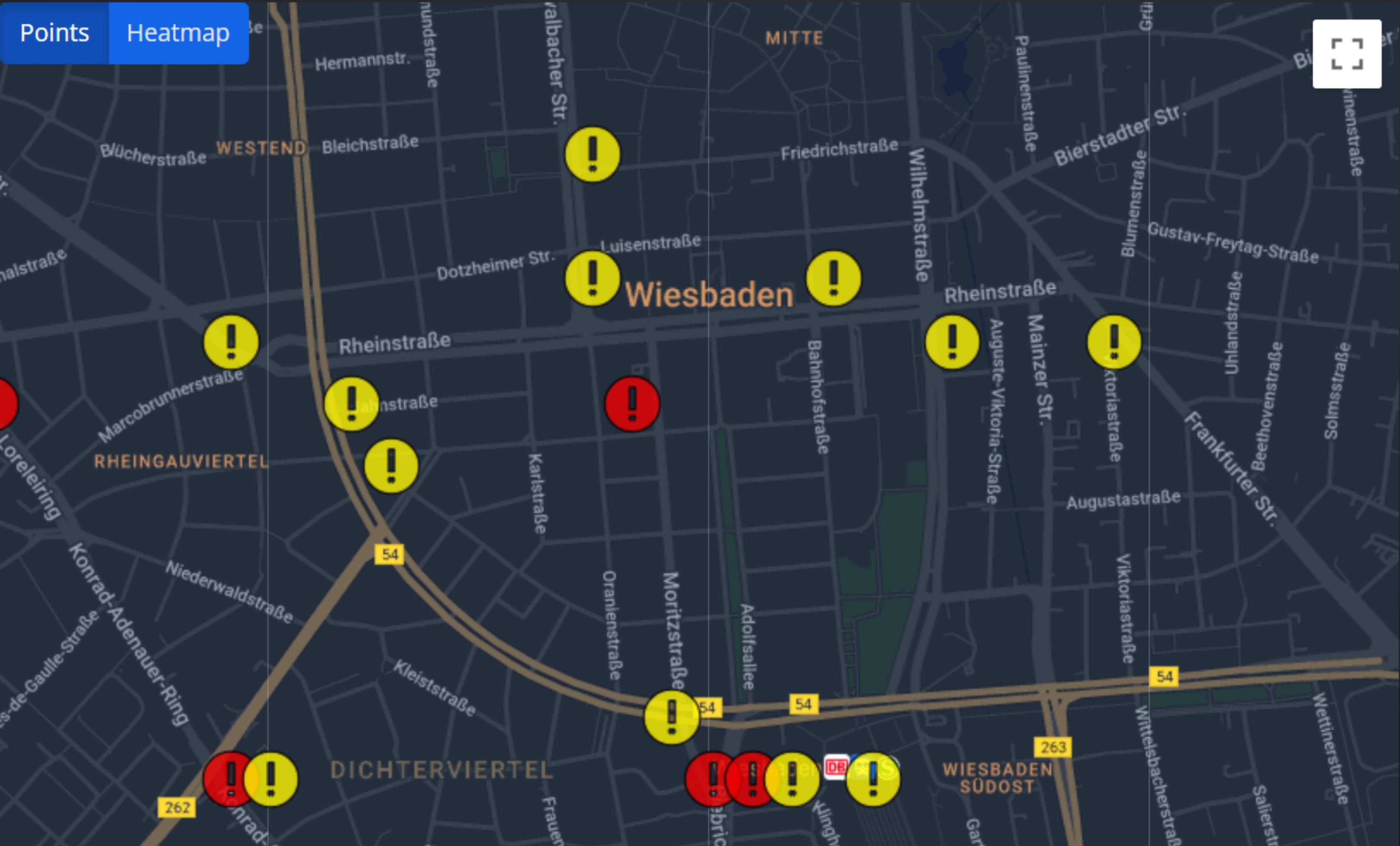
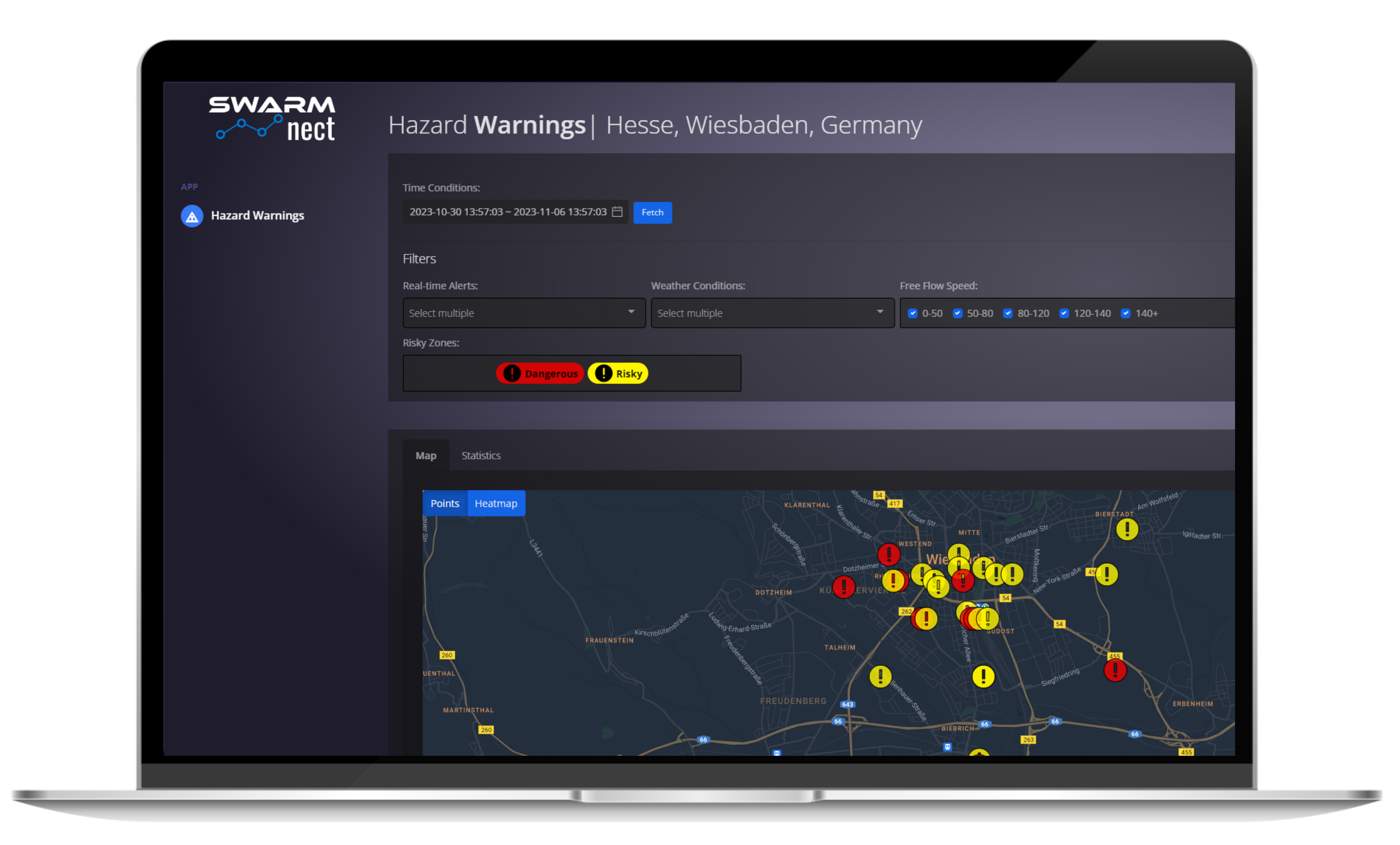
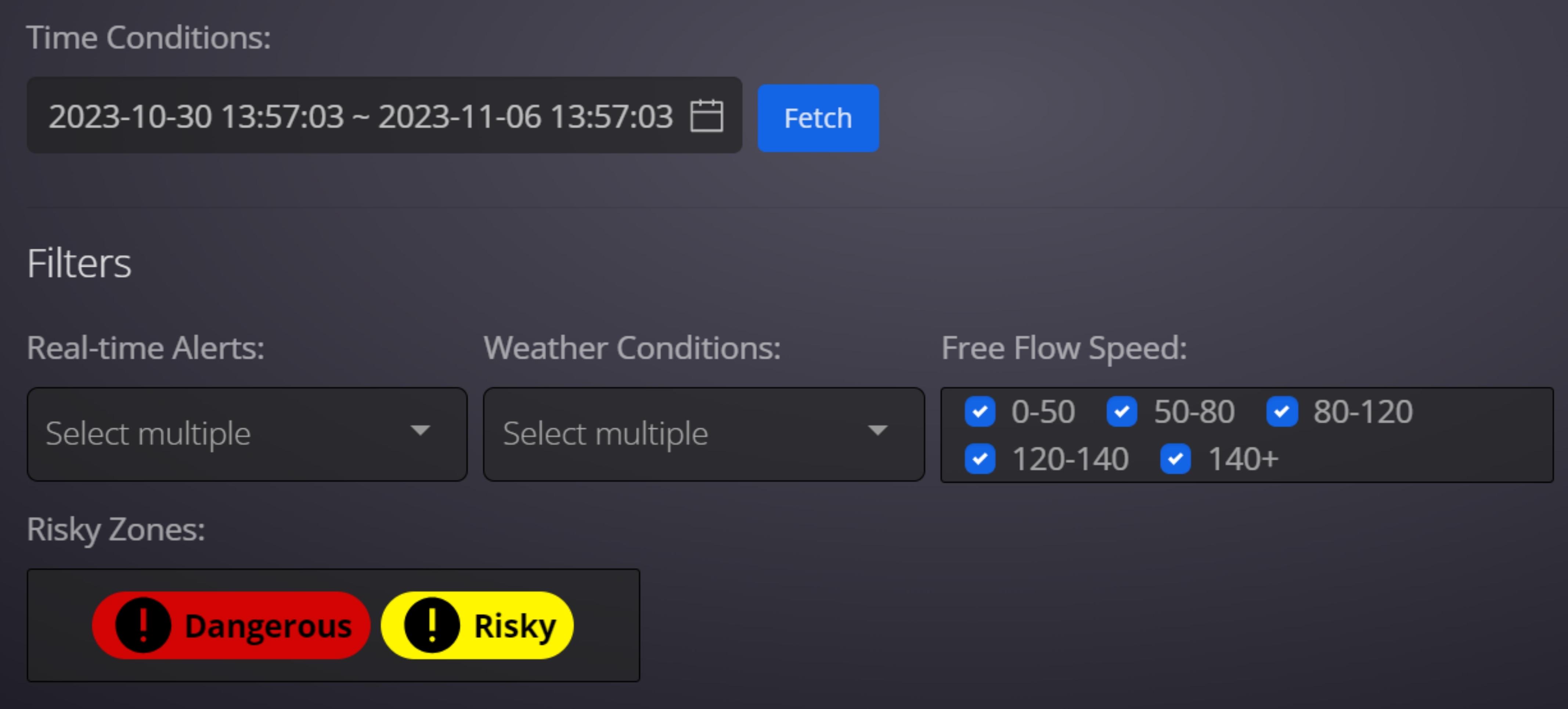
They are shared with the user on the "Hazard Warning Platform", which
displays the Dangerous Zones on the map and generates warnings.
Why Hazard Warning?
Data Analytics and Planning
Analyzing the collected data is used to build future traffic
Emergency Response
Emergency teams enables faster andmore effective intervention.
Pedestrian Collision Warning
Drivers can optimize their fuel
Lane Departure Warning
Provides drivers with information about potential hazards.
Over Speed Warning
It shows the road condition on the map and helps drivers choose alternative routes, thus reducing driving time.
Why Hazard Warning?
Data Analytics and Planning
We offer the user solutions to improve road infrastructure and provide risky zone warnings with our artificial intelligence algorithms.
Emergency Response
We enrich this data by drawing meaningful conclusions from the data we collect.
Pedestrian Collision Warning
We collect locations with accident risks, vehicles performing sudden braking and slalom, and real-time accident data for traffic safety.